Biking Because

"Bikes are the cars of the future" – Sean O'Neill.

Tag: touring

The Road Well Travelled

The Yellowhead Highway or Hwy 16 is the main artery from coastal Prince Rupert to central Prince George. Known locally as the Highway of Tears for its haunting past. Over the past number of years many local, predominantly native women have disappeared while hitch hiking along the road. Its hard to put into words the eerie feeling you get, there’s a tangible cloud of tragedy or loss that hangs in the air. Its pretty striking the number of memorials and crosses dotted along the roadside.
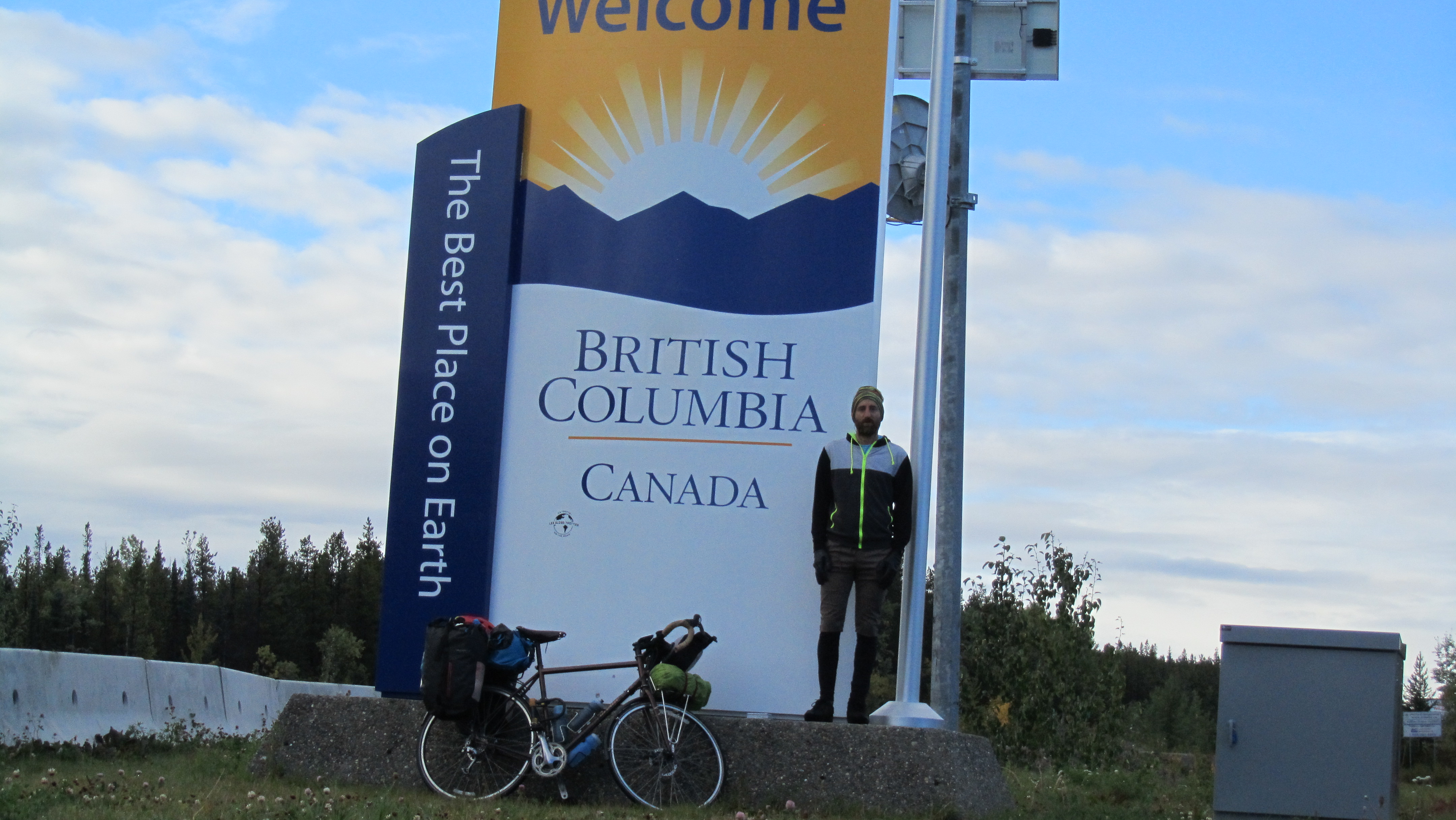
Sign On the Road

Sign On the Road

An array of huge mountains towering to the south welcomes you onto the Yellowhead, the Rocher Déboulé Range. The largest of which is …. Brian Boru Peak. I did a double take at the map, but sure enough there it was. A mountain in central British Columbia named after the most notorious High King of Ireland and like myself a Clareman.

Brian Boru Peak

Brian Boru Peak

Its big farm country here. I’m noticing for the first time isolated farm houses and fencing around fields, not the norm up until this point. Huge logging trucks roll by, a couple every hour. Massive machinery is transported north for mining operations on the Cassiar and further north. Industry is booming and that’s very evident. On through the Hazeltons and towards Smithers where I stayed for a few days. It’s a picturesque place with a smart, rustic downtown. Really liked this little town. I stayed with a doctor who is about the leave the profession and embark on a bike adventure of his own which will last a couple of years. We connected via the bike touring equivalent of couchsurfing.com.

IMG_5275

Farm country

Prince George, what can I say. Industry pumps a layer of pollution which sits just above the city clearly visible from my approach. Not much in the way of cafes or bars, its a busy town where people in their spare time seem to prefer an escape to the country. Stayed with my buddy Sean, I was glad of the comforts of home for a few days. The route out of town is the Cariboo Hwy, a straight shot from Prince George to Cache Creek.

Strange cloud over the Cariboo/Chilcotin

Strange cloud over the Cariboo/Chilcotin

From here down its all about big highways and big trucks, not conducive or designed for riding a bike and the wildlife is noticeable by its absence. This stretch of the trip is one which is very much touched by the industrial arm of humans. Next is the Sea to Sky Highway where I’ll welcome narrow roads, significantly less traffic and the route to Vancouver …. nearing the end.

Alone on the Cassiar

IMG_5100

Entering BC

Unbeknownst to me, turning off the Alaskan and onto the Cassiar Highway would hold a future of mixed fortunes. Testing my limits and pushing me to the point of almost throwing in the towel. While I was happy to be back in BC, the weather took a terrible twist. It rained, it rained so much that I’d willingly have swapped it for the worst of the west coast of Ireland and that’s a statement worth analyzing. The wind pushed against me, the climbs became struggles. Progress sputtered and stagnated. I was constantly miserable, cold and wet. The routine was biking wet, setting up my tent wet, taking it down wet, cooking in the rain. I wasn’t covering nearly enough distance. Then Mt Doom, the pinnacle of misery, the shit-sprinkles on top of the shit-cake….my airpad burst, now I was sleeping on the floor of a cold, wet tent. You’re getting it, misery.

IMG_5217

Sniffing my food

IMG_5202

Staring me down, look closely you can see Salmon in the river

The good news is I’m still going and here’s why. Whenever I felt at my most miserable something beautiful would always reveal itself, reminding me of what I was doing and where I was, re-energizing me to keep trudging on. The first; as I struggled into a cold, hard headwind I noticed something up ahead but I couldn’t make out what. As I got closer it became clear, a Lynx and 3 cubs ambled across the road, something that is extremely rare to see. It made me smile and inspired me for the rest of the day. The second; so my airpad burst, I was camping in Kinaskan Provincial park and the weather was awful. I casually mentioned to the park operator about my airpad. She turned up 10 minutes later with a therm-a-rest airpad for me, said I could keep it and didn’t charge me for camping either…energy levels rising.

IMG_5131

Good Hope Lake

I woke up the next morning to clearing skies and the sun which I hadn’t seen for a week. In the next 3 days things picked up rapidly. I was riding my bike on an isolated stretch of the Cassiar and I noticed something up ahead. A black Bear, shit! I stood tall on my bike and kind of yelled at him. He looked at me, sized me up and sauntered off the road. This happened again about 5 miles later. The next day, I was on the side of the road cooking some lunch, looking around I saw a Bear coming my way. Luckily he veered into the bushes and I didn’t see him again.

IMG_5128

Good Hope Lake

I camped in Meziadin Provincial park for a night, beautiful setting. The next day I was leaving and noticed some people gathered by a creek about a mile down the road. Leaning my bike against the rail I took a look. Incredibly, a Grizzly was in the stream about 15ft below intensely focused on catching the spawning Salmon. He could so easily have just come up the embankment and eaten any of us I thought. He must have been reading my mind because that’s exactly what he did. He got between the people and their cars then casually strolled over to my bike of all things…I pictured him tearing my gear to shreds and having a field day on my food stash. Not today, he turned around and went back to fishing.

IMG_5176

Black Bear on the road

I’m in a place called Kitwanga now and as the Cassiar comes to an end I’ve had time to think, it was an experience I’ll remember for some time. Next up is the Yellowhead, the Highway Of Tears.

Meet the Alaskan Highway

Taking me from Fairbanks to Whitehorse, the Alaska highway is steeped in history. It fed the area with hordes of people desperate to strike it rich during and after the gold rush. The landscape along the highway is varied, it moves between dry almost desert to huge treed mountains to enormous bare mountains. The Tanana river valley has some stark viewing, thousands of half dying trees line the muddy flats of this basin. I believe something in the soil leaves the trees this way.

greyish, limbless trees of Tanana Valley

grey limbless trees in Tanana Valley

Crossing from the US into Canada at Beaver Creek I felt more at ease somehow. Maybe I won’t see a man casually stroll into a grocery store with a gun and holster hanging off his hip (3 bears grocery, Tok) or maybe its comfort in the knowledge that if anything happens to me, I’m covered! The two biggest changes on entering Canada, no cell phone reception and back to gravel roads. Kluane national park in the Yukon is simply riveting, with more stunning scenery than I had realized. I was in awe passing through Kluane with my mouth agape most of the time. Bugs..I swallowed lots.

IMG_5047

Kluane National Park

Being on a bike you notice the wind, up here it seems to change direction multiple times every day. I suspect all the massive mountains have a huge impact on wind patterns.The route is mostly flat with some minor climbing, but after the Dalton I’m very much ready. Kluane seems little known with not much in the way of facilities. The St Elias range is breathtaking, lake Kluane and its eye grabbing backdrop is no runner up.

IMG_5059

Mt Logan is Canada’s biggest

As for wildlife on the Alaska highway, I’ve seen some. One campground I was to stay at outside Destruction Bay was closed to tent camping because of aggressive bears in the area. A mother grizzly bear with a cub crossed the road in front of me, I’ve seen Moose, some turned and ran others stared me down. Also beavers, sandhill cranes, eagles, ospreys, trumpeter swans and ground squirrels. When you are up close with a large wild animal pretty much the last thing on your mind is getting a photo.

IMG_494

Moose cow and calf

For now I’m going to rest up in Whitehorse and in a few days I should be back in BC on the Cassiar highway.

The Arctic and Me

image

    (Warning : this is going to sound melodramatic but I’m sensitive so shut up)

     One of the most grueling journeys I have or will ever undertake. It’s remarkable how windburn, sunburn, exhaustion, torrential rain, snow, sub zero temps, freezing fog, unrelenting biting insects  and 500 miles of climb after unforgiving climb (27,000ft) can all make you quickly forget about bears and wolves. Have mercy on the ill prepared, I was not one of them. Thanks to my mosquito suit I only got about 50 bites, there is just no escape. You had me question my sanity and my decision to come here many times.

image

Those black dots are Musk Ox

     Prudhoe bay is a fly in/ fly out oil field on the Arctic ocean. It is a desolate barren place with freezing fog and bitterly cold winds, it resembles what I imagine the surface of the moon to be like. But…. there is also incredible beauty here. The vast open expanse of the Arctic tundra is an awesome sight to behold. Atigun pass and the Brooks range are spectacular and awe inspiring. North of the Brooks is Arctic tundra as far as the eye can see and almost magically once over the pass is the beginning of forest. The slow trickle of sparsely growing trees pockmarked here and there quickly flows into a full forest.

image

Atigun Pass

     There is a discernible difference in the wildlife from other places that I have been, it must be from the little exposure they have to people. I got to within 15ft of a bear and he didnt seem to know what I was. I saw herds of migrating caribou being stalked by hunters , even got chased by one (not a hunter). I also saw Musk Ox.

image

     Once over the Brooks the climbs become more and more arduous. Common tactics such as switchbacks and winding roads around mountains are not employed here, straight up and over. The Dalton “Highway” (mostly gravel/dirt road) was built as the most direct route from Fairbanks to Prudhoe. It’s featured on the TV show Ice Truckers.

image

     Trundling down the final descent, with my hands clamped on both brake levers as usual I did not feel as though I had just conquered something, but more a feeling of respect, of thanks, for letting me pass through because you could have shut me down at any time..

I’m in Fairbanks now for a day or two of rest, bike repairs and to get new panniers. The old ones were chewed up on the road. Then on to Whitehorse.

On the Remote Boat

I’m writing this update from the house of some Anchorage biker enthusiasts who put me up for a few days. Great folks who couldn’t do enough. Soooo, the ferry ride from Bellingham to Whittier was epic. There were cabins but a few people including myself camped on the top of the ferry deck in a solarium. 5 days later I’d seen pods of Killer whales, dolphins, majestic scenery, tiny native villages tucked under daunting mountains and a rare gathering of about 30 Humpback whales in their feeding ground. image The most dramatic was saved for the last day. So every port I took my bike from the car deck and biked into the nearest town or just to stretch my legs. We arrived in a small native town of Yakutat at 5am and I was ready to get off. The Captain announced "We are requesting no one disembark, there are two injured Grizzly Bears on the beach…." Holy Shit!! So I went to have a look. There was a guy on the beach with a gun trained on the treeline. We watched… and watched… nothing, couldn’t see any sign of a bear. People started to head back to sleep. Then all of a sudden… BANG.. BANG… 2 shots rang out. I saw this medium sized grizzly bolt from the treeline to the water and start to swim. Incredibly he seemed uninjured and continued to swim across the bay, easily a couple of miles. It was crazy. image On to Whittier where I get off. Cold, rain and ominous grey skies greeted me. Plus an impassible tunnel for bikers. I got a spin to the other side, the skies were clear and the views were amazeballs. Biked the beautiful 90km+ to Anchorage. For directions, garmin bike computers suck balls. Anchorage is cool. It is plopped in the middle of wilderness, Bear bins and Moose in the city center.

Today I’m flying to Prudhoe bay and the trip will start in earnest.